|
|
|
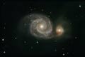
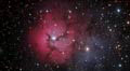
Astral Imaging at Dogwood Ridge Observatory |
Latitude: 37°48'51.0" N" |
|
|
|
|
|
|
|||
 |
|
|
|
||
|
|
|
|
|||
|
(click on thumbnails to go to that image's page)
|
|||||
| ||||||||||||||||||||||||
|
|
Alaska Trip Glacier Bay National Park
These are pictures we took entering Glacier Bay on our way to Margerie Glacier. It was amazing how much beauty and life surrounds you in the wilderness. Everywhere you looked was majestic. Snow capped mountains, waterfalls bursting as the snow cover melts, ice flows floating along the waterways. The sea otters swimming along and then floating on their backs as if not a care in the world. And yet the wild is treacherous with each species having their own natural predators not to mention the threat of man. We even saw an eagle that had landed on some floating ice that just seemed content to sit there and watch as the world drifted by. No, not the seagulls above although I found them interesting in themselves. Stats:
| |||||||||||||||||||||||||||||||||||||||||||||||||||||||||||||
| |||||||||||||||||||||||||||||